Virtual Wargaming Tables
Company: Masters of Pie | Client: The British Army
I program managed 4 phases of work to deliver augmented reality 3D GIS wargaming tables, visualising synthetic intelligence data for the British Army, working closely with HQ 1 (UK) Division & 12 Armoured Brigade Combat Team, generating over £4m in revenue.
“Conducting a rehearsal of concept drill inherently holds more risk than within the planning function, as the briefing down of orders and ensuring correct interpretation is difficult when geographically distributed.”
The modern battlefield demands dispersed mobile headquarters.
Traditionally, officers would be collocated at a command point, leaning over a table with a paper map, some printed acetates with annotations and features described, and pins to represent units, e.g., platoons, battalions, etc. Here, they would plan, wargame, and brief the operational orders.
The current Eastern European conflict has made it brutally clear that having all your commanding officers in one place is enormously risky due to the evolution of precision drone and artillery strikes.
Moving these processes of planning & briefing was achievable, albeit not always optimal, to current conferencing solutions like Microsoft Teams.
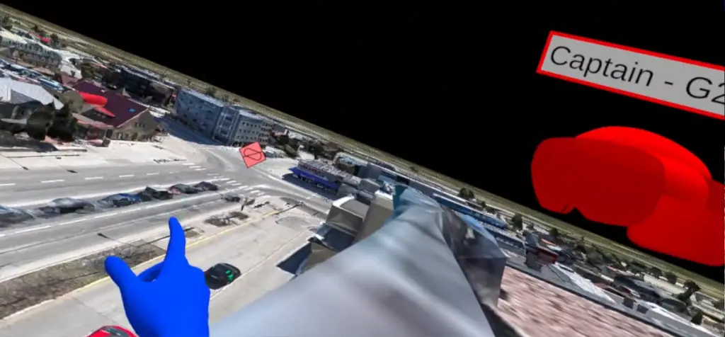
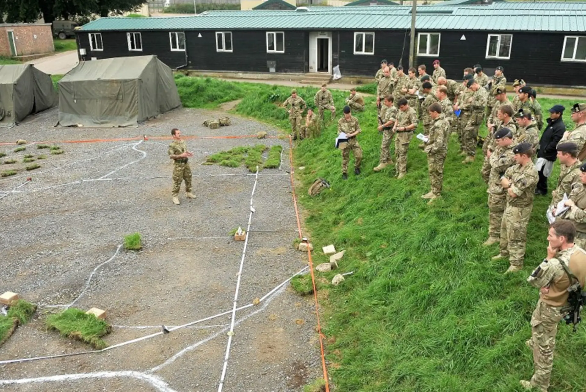
However, a ROC (rehearsal of concept) (see image top right) often requires significant space, preparation time, and co-location of commanders and their subordinates in order to make it effective. The commander uses the ROC drill to validate that their intent (the operational goal) can be achieved by the subordinate groups whom demonstrate as they step through their plan, often literally moving in person around the map as the plan is discussed and the various unit commanders called upon to present what they are doing at certain points of the map.
ROC drills are not just reserved for the military and are sometimes used for policing and national security. For example, the 2017 presidential inauguration was rehearsed by various security forces on a basketball hall sized map so that each group could coordinate with the others, and it was clear what they should be doing at each stage.
For this activity, using conventional conferencing tools is not adequate. When this issue was identified by 1 Div(HQ) in the British Army, I led a 4-phase program of work to develop a new capability. This utilised the latest in virtual and augmented reality technology, initially starting with the Microsoft HoloLens 2 before being ported to the Meta Quest 3.
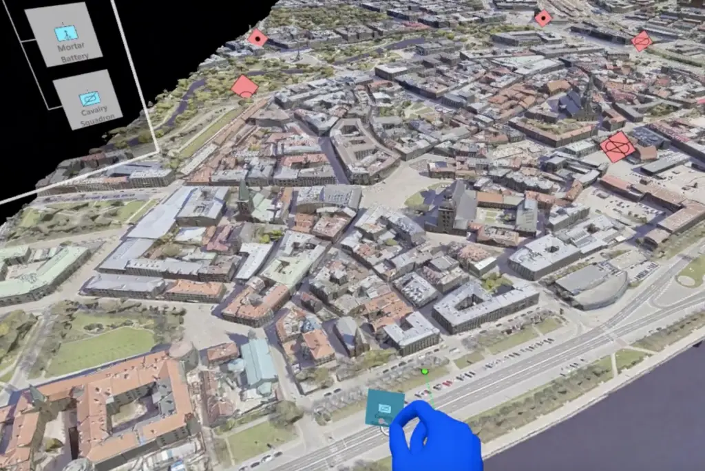
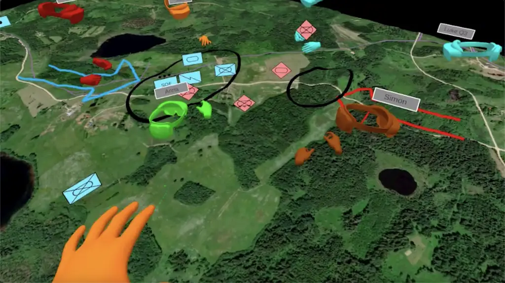
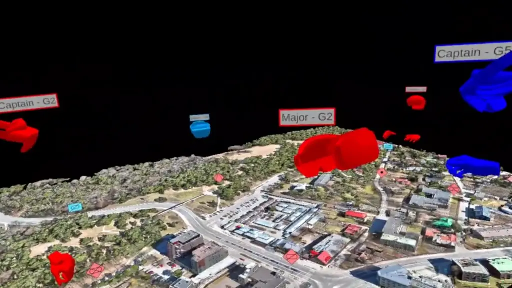
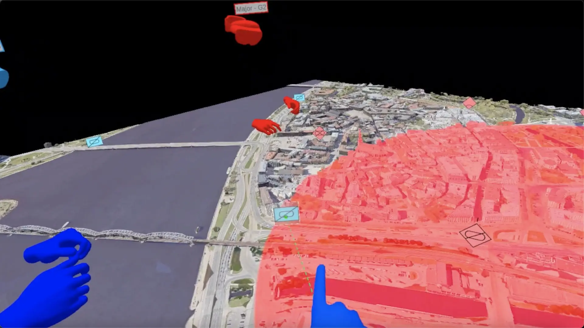
The essential characteristics of a ROC drill are spatial and collaborative. Therefore, the system needed to allow users to join and collaborate with a map that could expand as large as needed. No longer are we constrained by the size of the space we conduct the process within. Likewise, due to the digital nature of the system, we can bring in live data from various sources, in this case, Hydra (an internal Army tool) that could pull in red and blue force units (with correct NATO symbology) and 3D mapping data from ESRI ArcGIS, a GIS authoring tool used throughout the Defence community. As this capability was mixed reality (it could be augmented over our real world or be fully immersive in VR, replacing our world), we also introduced “street view” (see image below) where the user could “walk the land,” providing massively enhanced situational awareness.
With this technology, we could bring in a drone LIDAR scan of a town or city (for example, the latest 3D picture of an Eastern European giving officers the most up-to-date high definition understanding of the battlefield, assemble a ROC drill in minutes instead of hours or days to rapidly speed up decision making.